Day 2 of our adventure begins just as we had thought. Rain continues to fall on our tents and the chilly air is not inviting for removing oneself from a sleeping bag. Unfortunately, nature calls. I grab a rain jacket and fall out of the tent with the dog. We trundle up past the bear bag since we're above the leaf out and there's not much cover for squatting.
 |
| Fog rolling over the mountains as we begin our hike on day 2 |
I bring the food back to the tent and scramble back inside. It's pretty miserable out, but the rain seems to be slowing down. Northwest discovers that a small critter has chewed through the bear bag. None of the food was touched, but everything inside is soaked. Thanks, critters. Northwest and I make the command decision to not make a warm breakfast and just start packing up to see if we can get off the mountain before the deluge begins again (much to Liz's dismay since she was hoping for coffee). Liz suggests we disassemble the tents under the rainflies which leads to one of the greatest discoveries about our tents I've ever seen. All our dry gear stayed dry! Had we been staying one more night this would have proven very helpful. I stuff the last of the junk into my bag and hear Liz unzip her rainfly and step out into the morning.
"I think it stopped raining..." she cautiously calls out. By golly, it had.
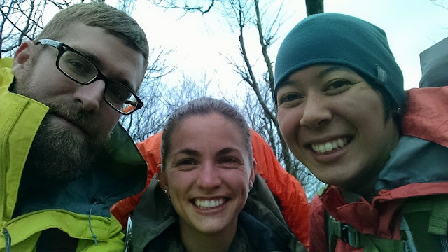
The night before our Raleigh friends had also decided to escape down Jenkins Meadow trail, but they were slow to rouse. We went over to their camp to say our goodbyes and checked the trail sign at the trail junction and reviewed our map. The clouds were quickly moving out, and we could see bits of the valley below. We wanted to get out fast, but in case we got caught in a downpour we donned all our rain gear.
 |
| Ready for our hike in the rain - also, it was chilly enough for the beanie |
Everyone's mood is pretty bright being that it's practically sunny, it's warming up, and we knew in a few hours we'd be chowing down on pizza and knocking back brewskis. We headed down what we believed to be Haoe (Hay-yo) Lead Trail which would take us to Jenkins Meadow Trail.
We were wrong. Very wrong. The worst kind of wrong.
There's a trail in the wilderness that is lovingly referred to as the "Ball Buster." The last 5.3 miles of the trail ascend a total of 535 feet every mile over dead trees, washouts, and boulders. And guess where the upper terminus of the Ball Buster is? Yes. You guessed correct. At Naked Ground Gap.
Now, the trail junction was marked with a formal sign: "Naked Ground behind us. Bob Stratton to the left. Haoe Lead to the right. Slickrock Creek straight ahead." Wilderness areas are, just as the name implies, wild. Small budgets leave much of the maintenance performed by volunteers. Volunteers can only do so much in a wilderness that covers 33,620 acres. So what we thought was an overgrown section of Slickrock Creek Trail was probably only a social trail. The trail we thought was drainage pattern was actually Haoe Lead. As I said before, we were the wrongest of wrongs.
The clouds above us no longer linger. An amazing "fog" has settled over the valley below. We're walking at a pretty good clip and now in the sun. Our rain gear is starting to make us sticky, but you never know when that rain will pop up, so we endure. Someone asks, "Are we on the right trail?" I don't remember who the first one was, but I remember we were all thinking it. We pull out the map and (mostly) confirm we are correct. We continue. We are overcome with suspicion again. We get out the map and the remainder of the Nalgene of merlot and talk it over.
 |
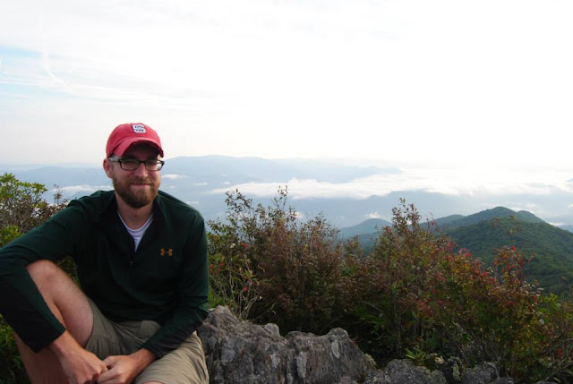
| At least we were rewarded with beautiful scenery! |
This is the origin story of Northwest. According to the map we should be headed roughly southeast. Once we are up and walking again, hubsters continually alerts us to the fact that according to the cheap ass compass on the Kmart hiking pole we are heading northwest. About every 10 minutes. All 3 of us are cranky from lack of sleep and the sweltering heat our rain gear is creating. Quiteness ensues between bouts of grunts.
Hindsight, eh?
We finally take off the rain gear because there are no clouds in sight. We all knew we were on the wrong trail, but we didn't know which trail we were on and none of us wanted to hike back up what we just came down. But also, none of us voiced these opinions with stubbornness. So the second dumb thing we did that day was carry on in the same direction. All the while from the back we would occasionally hear, "We're still going northwest."
We keep trying to make it ok. "This is kinda meadow like," (referring to Jenkins Meadow) someone would say. "Definitely," another would answer. "At least it's not raining!" feigned enthusiasm. "And the scenery is gorgeous!" real enthusiasm. Later we all agreed it was at least a beautiful trail to get lost on.
After a stream crossing and many breaks and one other not so smart move of separating shortly we've all just about had it with being outside. The pups were slowing down as well. I can see the stress building among us all. I try to remain calm so I can think rationally. I give Northwest a pep talk. I try to keep Liz's mind distracted by making her laugh.
We eventually (after some unknown hours of hiking) come to a flat area near a stream. I stop in my tracks. "This looks like a trail junction," I say as calmly as I can. I can see social trails all over. I scan the trees.
"THERE! A SIGN! ON THAT TREE!" I point vigorously as I start jogging over.
"SLICKROCK CREEK"
"Get the map."
Northwest and Liz lay the map on the ground and I locate the creek. "I think we're here. I'll be right back." I leave them and walk down a social trail.
BOOM. Trail junction sign. I memorize its contents. I read it one more time because I'm exhausted mentally and want to make sure I have all my facts straight when I go back to the group.
The others are still pouring over the map when I get back. "I know for certain we are here," I point to the junction and explain myself. I know there is a trailhead at Big Fat Gap.
"We have a few options. Best option is we hike up to the trailhead and hopefully someone will be there to take us to the car. Let's try for it."
We saddle up and head off on Big Fat Gap Trail. Looking at the map I realize the hike out is straight up and out of the watershed. It's going to be tough. I guess the others didn't realize it. They start to lag behind. Lego was so tired I didn't even keep her on leash the entire way up. She stayed right with me. Masi was slowing down also. We took quite a few breaks. The trail is only 1.5 miles, but it gained 1,050 feet. It's a nice wide trail - converted from an old jeep trail. It's the quickest way to Slickrock Creek...straight down.
I keep watching the horizon. Pretty soon the tops of the trees are getting shorter. We have to be close. I go into full bomber mode and march up the mountain. And then I see it. The backside of the trailhead sign.
"WE MADE IT! I SEE IT!" and many expletives spew from my mouth. But what I feared at the bottom of our hike came to fruition once I summitted. NOT. A. SOUL.
To make things worse the sign read, "Welcome to Natahala Forest." But we were in Joyce Kilmer. No trail signs were legible. Only a broken one with what we now suspect were the remaining letters to "Joyce Kilmer - Slickrock Wilderness."Even better is we have no cell phone service. And Liz's phone is about dead.
"Ok, next options," as we pull the map out again. "We can hike down to the highway or take this trail back to Jenkins Meadow." The response I get is a jumble of groans. "Ok, we can camp here tonight and hike out tomorrow. We have enough food." Them: it could rain....and we're done with walking.
"Ok, I'll hike down to the highway and hitch a ride. Or, I can take this trail and make it to the truck in about 2 hours if I only take snacks and water." (Side bar: my mental tiredness did not see that the second option was quite possibly the dumbest thing I've ever said. Never leave the group when it's not a medical emergency when you yourself are already physically and mentally done)
Liz wants to try to reach her husband at home one more time. She takes off up the trail to get better signal. After 15 minutes I go to find her. She tells me she can text him but nothing else. But her phone is on its last breath. I try to send a text out myself. It goes through and I get a response. It's slow going, but I have a half full battery. I confirm location details to our lifeline and wait for instructions. The last text I receive...
"They are coming to get you. Go back down to the parking area."
We wait an hour. Since it was after 4PM the forest service wasn't handling rescues. Liz's husband had called the Graham County Rescue Squad and they were sending a truck to get us. We joked about how pissed they would probably be. Having to pick up 3 hikers who needed no medical attention. They were just finished with hiking and too far away from their car. Then we were all quiet, because what if they were pissed?
Masi's ears perk up. Lego's next. Then we hear it. The sweet crunch of rubber on gravel. The truck crests the hill and Liz is so exalted she jumps with sheer joy. Three guys pile out of the truck smiling at us. We smile back. The older gentleman asks us how we are. We apologize profusely - none of us are hurt, but we ended up on the wrong trail and our car is back at Joyce Kilmer. He then hands us a box of apple pastries. "Here, my wife thought you'd be hungry so she handed me these as I left the house. Please help yourself." Humanity. It still exists.
We load our bags and dogs into the back and then climb into the cab. The guys reassure us we're the best kind of rescues they do. We're not dead and we're not at the bottom of the mountain. They regale us in stories of rescues they've done over the years. This is no easy job I quickly learn. Going out searching for people when they are at their lowest or possibly deceased. I couldn't imagine. I eat another apple pastry. They finally tell us we were not the first group of hikers to want to come out Jenkins Meadow and ended up at Deep Gap. "It happens all the time." We feel slightly better.
After a 30-45 minute ride we arrive at our cars. We showered our rescuers with more praise and thanks. Then we let them go back to their families. It's not long before we're loaded up and heading back to Asheville. Specifically to Asheville Pizza and Brewing for pizza and beer.
On Day 2 we hiked over 8 hours and 6.8 miles. We lost 2,850 feet of elevation going down Slickrock and gained 1,050 feet on the way back up to Big Fat Gap. Northwest gained a trail name - we'll see if he keeps it. We all gained humility in our thoughts we were navigating bad asses.
Northwest has sworn off the Joyce Kilmer - Slickrock Wilderness forever. Liz and I....well, you'll just have to see.
 |
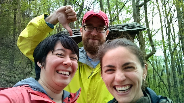
| Waiting to be rescued at Big Fat Gap. Only photo of Blake smiling. |


